 Skip to main content

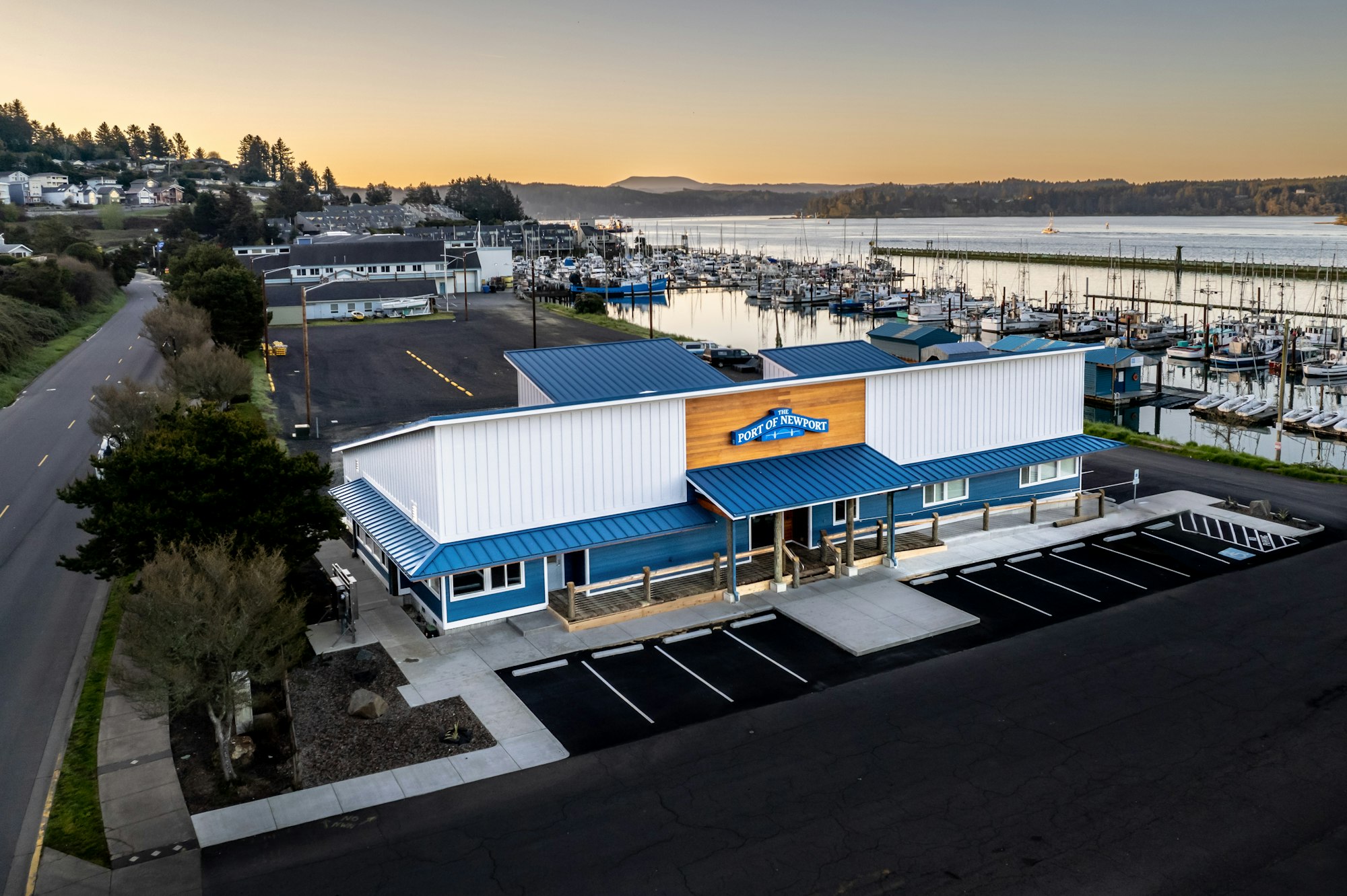
Feasibility Study for Navigation Improvements at the Port of Newport Commercial Marina
Interested parties are hereby notified that the U.S. Army Corps of Engineers, Portland District (Corps) released the Final Integrated Feasibility Report and Environmental Assessment for navigation improvements at the Port of Newport’s Commercial Marina, located on Yaquina Bay at approximately river mile 2 of the Yaquina River in Newport, Oregon.
This study was conducted under the Continuing Authorities Program, Section 107 of the River and Harbor Act of 1960, as amended (33 U.S.C. Section 577), which authorizes USACE to plan and implement small navigation projects.
The purpose of the project is to improve access and maneuverability for the commercial fishing fleet within the Commercial Marina, which currently faces constraints due to narrow and shallow navigation channels and moorage areas that have not been significantly updated since the 1940s. Larger vessels experience challenges with docking and mooring, contributing to operational inefficiencies and safety concerns.
The Recommended Plan includes:
- Deepening the existing west access channel to -22 feet Mean Lower Low Water (MLLW).
- Deepening all in-marina channels, including access to the hoist dock, to -20 feet MLLW.
- Deepening the hoist dock and Port Dock 7 moorage areas (as local service facilities) to -20 feet MLLW.
- Placement of approximately of the dredged material at the Yaquina Ocean Dredged Material Disposal Site (ODMDS).
The total estimated first cost of the project is $13,475,000 (FY25 Price Level), with a benefit-cost ratio of 1.1. The fully funded project cost escalated to FY27 is $14,266,000. The project is cost-shared at 90% Federal and 10% non-Federal for General Navigation Features, including channel construction. Improvements to moorage areas are a 100% non-Federal cost. The Port of Newport has expressed support for the Recommended Plan and willingness to enter into a Project Partnership Agreement should the project proceed.
The document will be available at: https://www.nwp.usace.army.mil/Locations/Navigation-Projects/Yaquina-Bay/Port-of-Newport-Navigation-Improvement-Project/
***************************************************************************************
Marine Protection, Research, and Sanctuaries Act (aka Ocean Dumping Act [ODA])
Ocean Dredged Material Disposal Site Designation Status. Dredged material from the Newport Commercial Marina project would be disposed at either the Yaquina North or Yaquina South Ocean Dredged Material Disposal Sites (ODMDSs). The U.S. Environmental Protection Agency, Region 10 designated both sites in 2012 pursuant to their authority under §102 of the ODA. The site locations, size, depths, uses, and restrictions appear at 40 CFR § 228.15(n)(15). A legal description of the sites follows (degrees, minutes, seconds; NAD 1983):
Yaquina North ODMDS
Corner Coordinates: Dimensions:
44° 38’ 17.98” N, 124° 07’ 25.95” W 4,000 ft by 6,500 ft
44° 38’ 12.86” N, 124° 06’ 31.10” W 597 Acres
44° 37’ 14.33” N, 124° 07’ 37.57” W Azimuth (long axis): 10° T
44° 37’ 09.22” N, 124° 06’ 42.73” W Depth: 112 to 152 ft
Yaquina South ODMDS
Corner Coordinates: Dimensions:
44° 36’ 04.50” N, 124° 07’ 52.66” W 4,000 ft by 6,500 ft
44° 35’ 59.39” N, 124° 06’ 57.84” W 597 Acres
44° 35’ 00.85” N, 124° 08’ 04.27” W Azimuth (long axis): 10° T
44° 34’ 55.75” N, 124° 07’ 09.47” W Depth: 112 to 152 ft
In both sites, the release zone (3,000 ft by 5,500 ft) is circumscribed within the site boundary, creating a 500-ft buffer around the release zone; the release zone is divided into 66, 500-ft square management cells arranged in a 6x11 grid.
Dredged Material Discharges at the ODMDSs. Prior to designation by the EPA, USACE selected the Yaquina North and South ODMDSs in 2001 under its ODA §103 authority. The North ODMDS has been used since 2001, and the South ODMDS was first used in 2012. A total of approximately 6.6 million cubic yards (CY) of dredged material has been disposed between the ODMDSs. Approximately 97% (6.4 million CY) of the quantity disposed was clean sand dredged from the Yaquina Bay federal navigation channel; the remainder (approximately 200,000 CY) was fine-grained sediment dredged from the Depot Slough side channel and adjacent Port of Toledo docks at Toledo, Oregon.
Documented Effects of Disposal at the Sites. The effects of disposal at the sites are jointly monitored by the USEPA and USACE. Management and monitoring activities at the sites are conducted in accordance with the August 2012 “Yaquina Bay North and South Ocean Dredged Material Disposal Sites, Site Management and Monitoring Plan” (SMMP). Disposal and monitoring activities described in the SMMP are a requirement of site use [40 CFR § 228.15(n)(15)]. The USEPA and USACE are updating the SMMP this year.
In accordance with the SMMP, USACE performs annual bathymetric surveys of the Yaquina ODMDSs prior to the dredging season, which typically runs from the beginning of July through the end of October. The USACE uses the site bathymetry to identify mounded areas and develop site utilization plans to facilitate even placement of dredged material across the sites.
The EPA plans and leads monitoring surveys at the sites, and the USACE participates in the surveys. The following table briefly summarizes the monitoring activities that have occurred over the last 26 years to document the effects of disposal at the Yaquina ODMDSs.
Year
Survey/Monitoring Activities
1999, 2000, & 2002
Benthic infauna surveys
2000
Baseline sediment evaluation with physical and chemical sediment characterization in the proposed ODMDSs and adjacent reference sites.
2001
Site evaluation study for MPRSA § 103 site selection
2008
OSV BOLD survey: sidescan sonar surveys, benthic infauna sampling, fish trawls, and physical and chemical sediment characterization.
2016
5-year monitoring survey (SMMP requirement): physical and chemical sediment characterization, benthic infauna sampling, epibenthic trawls, near-bottom water quality data collection
2018
Sediment transport study – evaluation of sediment movement at the ODMDSs “Yaquina North and South ODMDSs Sediment Transport Evaluation”
2021
EPA-led monitoring event: physical and chemical sediment characterization, benthic infauna sampling, epibenthic trawls, and water quality data collection
Project Duration. Construction of the Newport Commercial Marina CAP 107 project would take approximately 3.6 months.
Dredged Material Characteristics and Composition. Consistent with the dredged material evaluation requirements at 40 CFR § 227.13, the Portland District has evaluated sediments from the Newport Commercial Marina CAP 107 project in accordance with the joint USEPA and USACE 1991 Evaluation of Dredged Material Proposed for Ocean Disposal Testing Manual and the Northwest Regional Sediment Evaluation Team’s 2018 Sediment Evaluation Framework for the Pacific Northwest (SEF).
Physical Characteristics: Unconsolidated sediment in the dredge area (88%; ~194,000 CY) is composed gravel (0.0 to 1.4%), sand (38.6 to 98.0%), and fines (silt plus clay; 3.3 to 61.6%). Loose, degraded rock from the Nye mudstone formation (12%; ~26,000 CY) underlies the unconsolidated sediments. If placed at one of the Yaquina ODMDSs, the mudstone would be covered by >2 ft of unconsolidated sandy material from this project or by USACE’s hopper dredge, YAQUINA.
Chemical Characteristics: The Port performed chemical analysis on the dredged material in accordance with the SEF. Most chemicals were either not detected or detected in trace amounts.
Biological Testing: Solid-phase toxicity and bioaccumulation bioassays, and suspended-phase bioassays were performed by the Port in accordance with 40 CFR §227.13(c).
Determination: USACE has determined that dredged materials from the Newport Commercial Marina project are suitable for unconfined, aquatic disposal at the Yaquina ODMDSs. USACE is seeking the USEPA’s concurrence on this determination.
The proposed transportation of this dredged material for disposing of it in ocean waters is being evaluated to determine that the proposed disposal will not unreasonably degrade or endanger human health, welfare, or amenities or the marine environment, ecological systems, or economic potentialities. In making this determination, the criteria established by the Administrator, EPA pursuant to section 102(a) of the MPRSA, will be applied. In addition, based upon an evaluation of the potential effect which the failure to utilize this ocean disposal site will have on navigation, economic and industrial development, and foreign and domestic commerce of the United States, an independent determination will be made of the need to dispose of the dredged material in ocean waters, other possible methods of disposal, and other appropriate locations.
*********************************************************************************************
Newport CAP 107 Mitigated FONSI_Draft.pdfDRAFT IFR-EA_NewportCAP107_FOR Public Release_15JULY25.pdfAppendix A_Newport CAP 107_Engineering.pdfAppendix B_Newport CAP 107_Economics.pdfAppendix C_Newport CAP 107_Supplimental Environmental.pdfAppendix D_Newport CAP 107_Eelgrass_Modeling_Mitigation.pdfAppendix E_Newport CAP107_DMMP.pdf